
Ghost Town: Geneva Basin Report
Colorado is famous for ghost towns: long-forgotten and often abandoned rural towns that were once thriving communities. Many ski resorts in Colorado have had the same fate, what were once vibrant and bustling hubs would fade away into history, often because of financial problems, a lack of reliable snow, or an inability to stay relevant and compete with larger, newer resorts. Ever since I stumbled upon a copy of Powder Ghost Towns, I had been fascinated with exploring and touring these historic sites. Rich in both historical research and personal experience, Peter Bronski details 36 ski areas that have closed down over the years, and in doing so opens up a wealth of knowledge and beta to those interested in getting outside and experiencing Colorado history firsthand. I had also watched a film by The Road West Traveled titled, “Abandoned”, a really well done adventure short documenting the history of some of the more prominent closed resorts in the area.
A satellite image of the old ski runs at Geneva Basin. Source: Caltopo
Learning Caltopo and utilizing slope angle shading is one of the key methods of route planning I rely on to avoid terrain traps.
After flipping through Bronski’s guide every night for weeks, and obsessively building maps on Caltopo, I dialed in a location and easily convinced some friends to join. Deep into Pike National Forest, about 13 miles south of Georgetown, CO, lies a long abandoned ski resort: Geneva Basin. The ski resort operated intermittently between the 60’s and 80’s, finally closing its gates for good in 1984. But while the resort hasn’t operated in well over 20 years, and most of the structures had been removed by the forest service or the passage of time, it still holds a special place within the backcountry ski community of Colorado. A gentleman’s agreement between locals and the Forest Service has allowed for the old ski patrol hut to remain intact, the only true remaining structure left. Albeit a little dirty and cluttered, it’s maintained by volunteer backcountry users and is a great spot to rest and shelter from the elements before descending down one of the many old ski runs.
Skinning up the old cat track. The base area and Guanella Pass in the background.
Early season conditions existed in much of the approach.
We reached the trailhead bright and early and ascended to the base by skinning up Guanella Pass. January still brought early season conditions and the road was barely covered from a light snowstorm the evening before. Once beyond the winter road closure, what would normally be a somewhat busy tourist road in summer, becomes the backcountry. You’re miles from any sizable town, and apart from the gusting wind, there is a silence and peacefulness that stretches out along the surrounding peaks and valleys. The distance you have to put in to reach the zone keeps many people away, which is exactly one of the reasons this place is so special. Moose and mountain lion tracks imprint the snow, and you often get the feeling that you’re surrounded by wildlife, even if you don’t constantly see it.
At the base, an old cat track meanders south before multiple switchbacks direct you to the old hut, just north of the summit. On the way up just below tree line, we dig a quick handpit on a southeast gladed run. While the base is thin, we find the expected: multiple persistent layers of weak snow towards the bottom of the snowpack. We filled the pit and kept skinning up, continuing our discussion about how we want to learn more about avalanche safety and snow science.
Digging a quick handpit is not a replacement for a proper pit and test such as a compression test or extended column test, but does offer some quick information concerning the immediate snowpack on the slope you’re on. Here, we had a very minimal snowpack and were located on a very low angle slope, and as such just wanted a quick look at the layers.
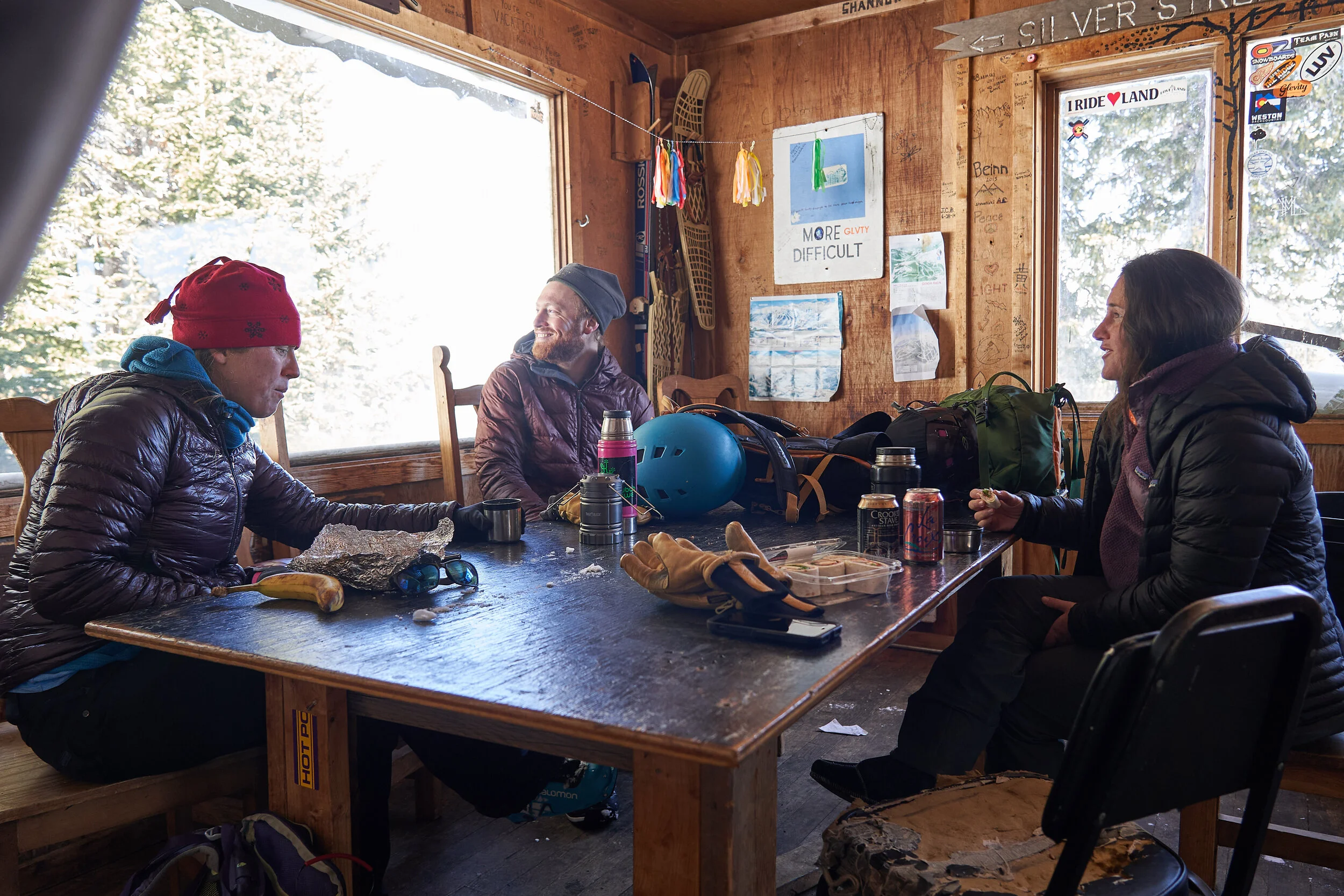
Walking into the hut is an experience itself, and one can almost feel the stoke of decades of backcountry users. And old wood stove sits in the sleeping room and a large wooden map illustrates all the trails and old lift lines on the mountain. The walls are full of sketches and notes, and if you take the time to look closely, you begin to piece together a written history of what the cabin has seen. A journal sits on the shelf and recent entries show many people have been visiting. I wonder to myself if the hut has always seen this much traffic, or only recently because of the pandemic. A small cluttered, make-shift kitchen has a window that looks out east to the Sawtooth, a jagged arête connecting Mt. Bierstadt to Mt. Evans. The hut has this strange and endearing vibe, like maybe some weird shit has gone down in here, but a lot of people have also made incredible memories there. I’m not sure who was able to advocate successfully for keeping the hut from being demolished, but I’m grateful for it.

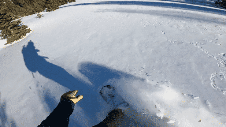
While many of the trails are remarkably intact, young firs and spruces have begun to take over in recent years. We pick our way down one of the east-southeast facing trails. The base is much deeper than we imagined and we struggle to find speed down the mellow hill. A few sections are just steep enough to let me sequence together some good turns on my splitboard. Back on the cat track, as the sun sets behind the ridge line, we find our exit down Mill Gulch. Backlit aspens surround the skin track as we race down the drainage, trying to keep our speed as long as possible. I hear a partially frozen river on my side as I recall how so many of my backcountry adventures have concluded with me dropping in elevation into an aspen grove, just before returning to civilization. It’s pretty incredible to have these massive organisms play a role in our forest ecology. I’m continually awe-struck upon walking through them. We drink good beers by the car and relish in how sore our feet are from a long day. On our drive out, the moonrise lights up a meadow and a few moose cautiously chew on willow. I’m reminded why I spend so much time in the backcountry. I bite into a cold Bobo’s bar and wonder when I can come back.

Thank you Lauren Thatch, and Katie and Eric Schneider for getting outside with me for a long, leisurely tour and for always putting up with my camera in your face. Also, a hug thank you to Peter Bronski for your hard work that went into the book that is now such a great resource for us all. I look forward to many future adventures at lost ski resorts because of your research.